Seoul from space
Using the incredible tool that is Google Maps, I put together some satellite images of my neighbourhood. If you haven't searched for your own address yet, do it. It is scary how much detail you can see!
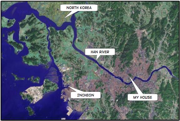
Zoomed out at this level you can get a good feeling for just how enormous Seoul is, and really appreciate the urban sprawl of the city. The Han River divides the city in half, with the older, more established areas north of the river, and the newer, hipper areas to the south. The Han River is not navigable by boats because the mouth of the river is within North Korean territory.
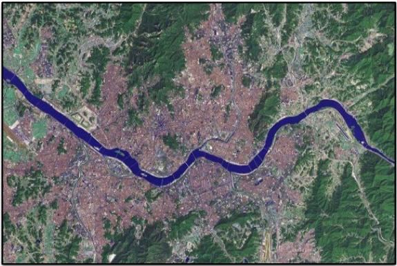
This view of Seoul reveals why it is so hot in city—an almost complete absence of green space! This city truly is a concrete jungle! According to UN Population Division figures, Seoul's urban area contained 10.3 million people in 2003, making it the 22nd most populous such area in the world. In Wikipedia's list of metropolitan areas by population, Seoul is ranked as the 4th largest in the world, and one of the most densely populated. Apparently Metro Seoul alone has more than 1 million registered vehicles! No wonder traffic-jams are so bad!

This view shows both my house and my school. To get to work I combine walking, the subway, and the bus. A one-way journey takes about an hour. And, this is something I never thought I would say, I really look forward to the time I spend on public transit: both the subway trains and buses are air-conditioned!
posted by Bryan @ 8/14/2005
0 comments
![]()
![]()


0 Comments:
Post a Comment
<< Home